
01
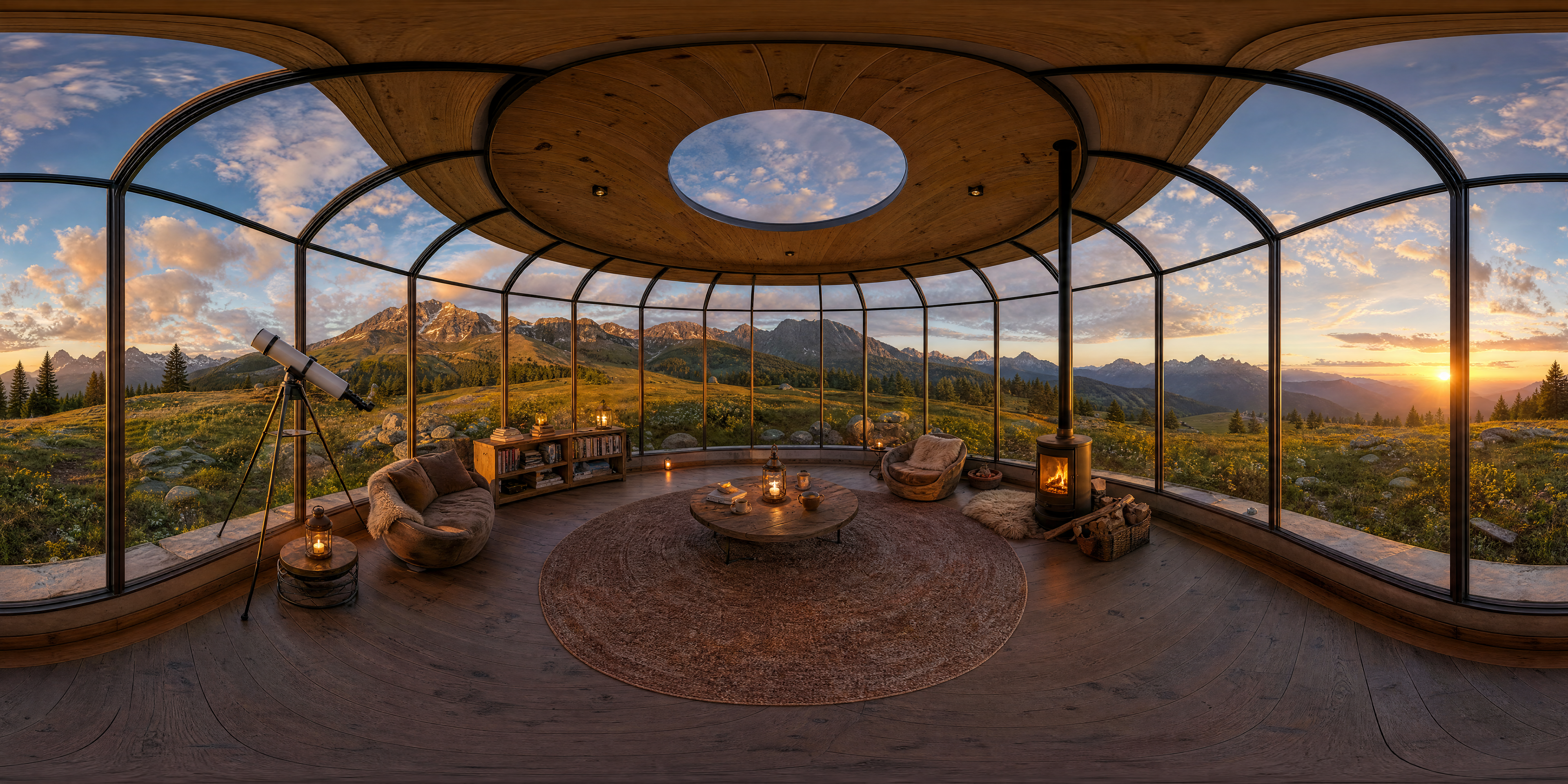
Full 2:1 lat/long texture
The complete 3840 × 1920 texture preserves the entire latitude and longitude map without cropping.
Copy a practical Nano Banana lat/long prompt, or use our model-neutral 360 Panorama Generator to create a fixed 2:1 equirectangular image from text or one reference image. A reference image guides the front view; unseen areas are generated, not recovered from the original photo.
Interactive output evidence
A wide image is not automatically a 360 panorama. Use the interactive viewer in the generator, compare the flat 2:1 texture, and place both edges together to inspect the wrap.
The complete 3840 × 1920 texture preserves the entire latitude and longitude map without cropping.
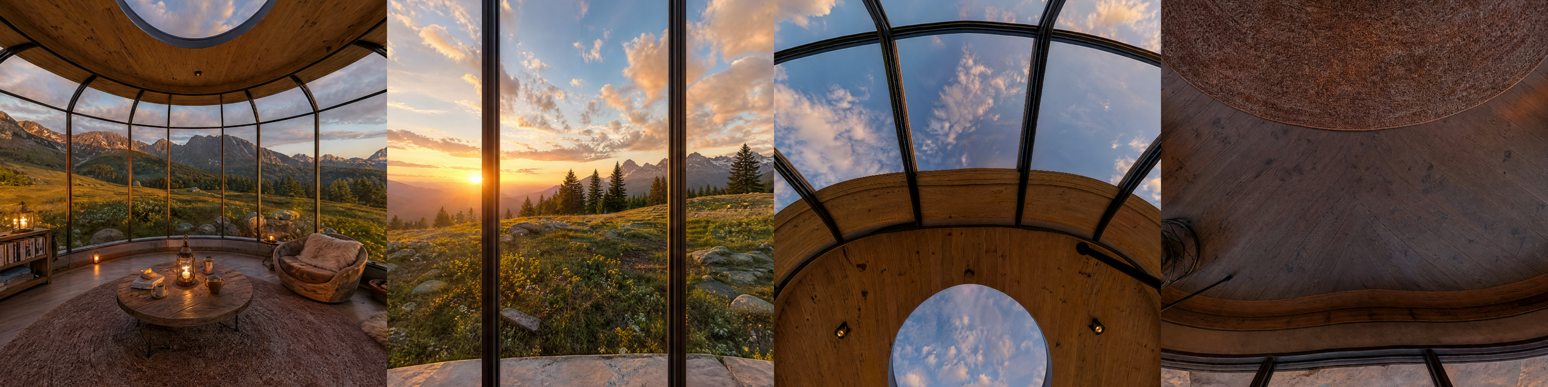
Front, rear, zenith, and nadir views reveal problems that are difficult to see in a flat image alone.
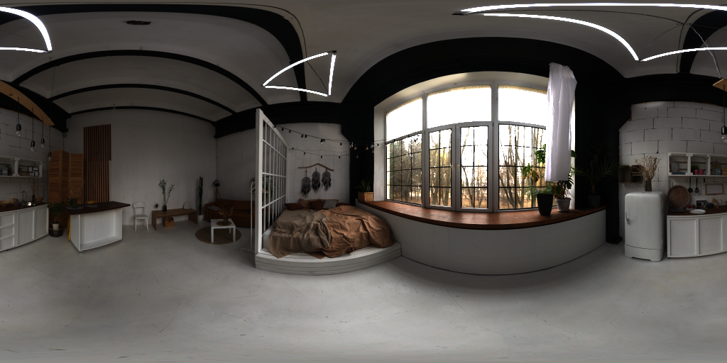
One image can anchor the subject and forward view while the generator imagines the unseen surroundings.
Copy and adapt
These prompts target the projection, camera position, horizon, poles, and wraparound edge—not merely a wide aspect ratio. Add your own scene details at the beginning.
Use the uploaded image as the forward-facing visual reference. Create a true monoscopic equirectangular latitude/longitude panorama with complete 360-degree horizontal and 180-degree vertical coverage. Preserve the main subject, camera height, level horizon, perspective, lighting, and style. Extend the environment naturally behind the camera, above to the zenith, and below to the nadir. Make the left and right edges represent the same meridian and join seamlessly. Output one continuous 2:1 image, not a fisheye circle, little planet, cubemap, collage, mirrored strip, or ordinary wide photo.
Create a centered-camera, monoscopic 360 environment from this scene: [describe the complete environment]. Render it as one strict 2:1 equirectangular spherical map covering 360 degrees horizontally and 180 degrees vertically. Keep the horizon level at mid-height, maintain coherent detail at the zenith and nadir, and make the left and right boundaries connect without a visible seam. Avoid duplicated landmarks, borders, split panels, fisheye framing, and little-planet projection.
Turn the uploaded room image into a true 2:1 equirectangular interior panorama. Keep the visible furniture, materials, lighting direction, camera height, and straight horizon. Extend the room consistently around and behind the viewer, including a plausible ceiling at the zenith and floor beneath the camera at the nadir. The left and right image edges must wrap into the same location with no repeated furniture or mirrored walls.
Build a complete equirectangular 360 panorama of [describe the landscape], viewed from a fixed central camera. Continue the terrain and horizon naturally through every direction, preserve a level horizon across the middle, create a coherent sky at the zenith and ground at the nadir, and join both horizontal edges seamlessly. Output exactly one continuous 2:1 latitude/longitude map with no frame or circular fisheye boundary.
The page treats projection requirements as a product contract, not as styling words added to a normal landscape prompt.
Every accepted result is a 3840 × 1920 PNG. A 4:1 banner or arbitrary wide crop is rejected rather than labeled as 360.
Seam Check places the right and left edges together so you can inspect whether structures, light, and horizon continue cleanly.
Drag through the environment, zoom, and jump to the front, seam, zenith, or nadir before downloading the flat texture.
Choose text when you want a new environment, or upload one scene image when preserving a subject and forward view matters.
Text to 360 builds a new environment from your description. Image to 360 accepts one reference image and uses it as the visual anchor.
Name the setting, lighting, materials, horizon, and what should exist beyond the visible frame. For an upload, state what must remain recognizable.
Look around the sphere, check the poles, then compare the last and first columns in Seam Check. Regenerate if important structures break across the wrap.
Use the original texture in a compatible 360 viewer, VR background, or environment-map preview workflow.
Projection basics
An equirectangular image maps longitude across the horizontal axis and latitude across the vertical axis. A complete monoscopic sphere therefore uses a 2:1 canvas: 360 degrees around and 180 degrees from the nadir to the zenith.
The left and right boundaries are the same meridian, so they must meet. The top and bottom rows collapse toward the poles, which is why distortion near the zenith and nadir is normal while disconnected objects or broken geometry are not.
For broader image generation, use the AI Image page. For single-view building visualization, use Architecture Render or Interior Design Generator. Those tools solve different framing tasks and do not promise a spherical output.
The downloadable result is intended for workflows that understand latitude/longitude panorama textures.
Preview a place from a fixed central viewpoint in web panorama viewers or as a monoscopic VR environment.
Explore fictional rooms, landscapes, game mood boards, and location concepts beyond a single camera frame.
Test an environment texture around a 3D scene. This tool does not promise physically calibrated HDR lighting values.
Image to 360 is a generative extension workflow. It cannot reconstruct scene data that was never captured by the source image.
The back, side, zenith, and nadir regions are inferred. Do not use them as factual evidence of a real location.
The inspection view helps reveal discontinuity, but it does not certify that every line, shadow, or texture closes perfectly.
The result is a standard image texture, not a depth-aware model, NeRF, Gaussian splat, stereo panorama, or calibrated HDR light probe.
Answers about prompts, 2:1 output, image-to-360 generation, seams, and compatible uses.
Ask for a true monoscopic equirectangular latitude/longitude panorama, complete 360° × 180° coverage, a centered camera, a level mid-height horizon, coherent zenith and nadir, and seamless left-right wrapping. Also say what to preserve from the uploaded image and exclude fisheye, little-planet, cubemap, collage, mirroring, and ordinary wide-photo output.
A detailed Nano Banana 2 prompt can request that projection, but prompt compliance and seam quality can vary. Check the output in a real 360 viewer and inspect both edges and poles rather than judging only the 2:1 silhouette.
No. This page provides Nano Banana prompt guidance and a separate model-neutral 360 Panorama Generator. The generator is identified by the task it performs, not by a public model claim.
No. A single photo only records one view. Image to 360 can preserve visible content and generate plausible surroundings, but the unseen sides, rear, zenith, and nadir are invented.
The horizontal axis represents 360 degrees of longitude while the vertical axis represents 180 degrees of latitude. Equal angular sampling therefore produces twice as many horizontal pixels as vertical pixels.
No. The ratio only proves the canvas shape. A useful panorama also needs coherent spherical geometry, a sensible horizon and poles, and left-right edges that describe the same location.
Rotate through the 360 view, inspect the horizon, look straight up and down, and use Seam Check to compare the right edge with the left. Regenerate if a major subject crosses the seam or geometry breaks.
You can preview it as an environment texture, but the output is a standard PNG and is not promised to contain calibrated high-dynamic-range lighting data.
Start with a scene description or one reference image, then verify the sphere, flat texture, and wraparound seam before downloading.